Geolocate

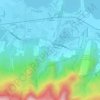
Turbina topographic map

Click on the map to display elevation.

About this map
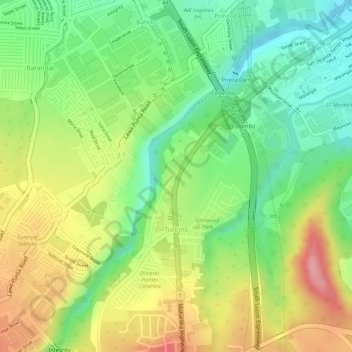
Name: Turbina topographic map, elevation, terrain.

Location: Turbina, Calamba, Laguna, Calabarzon, 4027, Philippines (14.18167 121.13308 14.19499 121.14283)

Average elevation: 82 m

Minimum elevation: 20 m

Maximum elevation: 152 m

Other topographic maps

Click on a map to view its topography, its elevation and its terrain.
Bucal

Philippines > Laguna > Calamba

Average elevation: 22 m

88 Spa & Resort

Philippines > Laguna > Calamba

Average elevation: 83 m

ASN Ph2 Park

Philippines > Laguna > Calamba

Average elevation: 133 m

Bucal Reservoir

Philippines > Laguna > Calamba

Average elevation: 42 m

Calamba Town Plaza

Philippines > Laguna > Calamba

Average elevation: 11 m

Casa de Palmera Resort

Philippines > Laguna > Calamba

Average elevation: 49 m

Gear up for your next adventure:

🦯Trekking Poles - Walking poles for hiking stability
🦯Adjustable Trekking Poles - Reduce impact on knees when descending steep topographic ridges
🧭Military Style Lensatic Compass - Durable sighting compasses for advanced land navigation and surveying
🛌Compact Down Sleeping Bags - Warmth without the bulk, ideal for backcountry camping
📣High-Decibel Survival Whistles - Signaling tool for rescue that carries much further than a human voice

As an Amazon Associate, this site earns from qualifying purchases at no extra cost to you.