
Courel topographic map
Interactive map
Click on the map to display elevation.
About this map
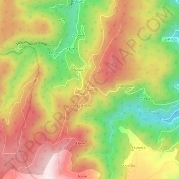
Name: Courel topographic map, elevation, terrain.
Location: Courel, A Órrea, Riotorto, Meira, Lugo, Galicia, 27744, España (43.23923 -7.26289 43.27923 -7.22289)
Average elevation: 545 m
Minimum elevation: 221 m
Maximum elevation: 823 m
Other topographic maps
Click on a map to view its topography, its elevation and its terrain.