Geolocate

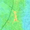
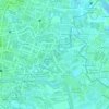
Capitol Commons topographic map

Click on the map to display elevation.

About this map

Name: Capitol Commons topographic map, elevation, terrain.

Location: Capitol Commons, Oranbo, Pasig First District, Pasig, Eastern Manila District, Metro Manila, Philippines (14.57390 121.06121 14.57789 121.06620)

Average elevation: 27 m

Minimum elevation: -7 m

Maximum elevation: 100 m

Other topographic maps

Click on a map to view its topography, its elevation and its terrain.
Pasig River

Philippines > Pasig

Average elevation: 14 m

Ortigas Park

Philippines > Pasig

Average elevation: 36 m

Pasig City Cemetery

Philippines > Pasig

Average elevation: 9 m

Parian Creek

Philippines > Pasig

Average elevation: 6 m

Bridgetowne Central Park

Philippines > Pasig

Average elevation: 11 m

Parian Creek

Philippines > Pasig

Average elevation: 6 m

Gear up for your next adventure:

🧥Packable Rain Jackets - Breathable waterproof layers for unpredictable mountain weather
🛠️Outdoor Repair Kits - Gear repair kits
🎒Ultralight Backpacks - Lightweight packs for long hikes
⌚Altimeter Watches - Watches with altitude tracking
🎒40L Day Hiking Backpacks - Comfortable packs with hydration support for long days exploring topographic peaks

As an Amazon Associate, this site earns from qualifying purchases at no extra cost to you.