Geolocate

Rio do Rastro topographic map

Click on the map to display elevation.

About this map
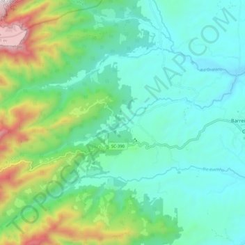
Name: Rio do Rastro topographic map, elevation, terrain.

Location: Rio do Rastro, Lauro Müller, Região Geográfica Imediata de Criciúma, Região Geográfica Intermediária de Criciúma, Santa Catarina, Região Sul, Brasil (-28.39505 -49.54455 -28.36090 -49.44347)

Average elevation: 544 m

Minimum elevation: 233 m

Maximum elevation: 1,526 m

Other topographic maps

Click on a map to view its topography, its elevation and its terrain.

Cânion do Funil

Brasil > Santa Catarina > Lauro Müller

Average elevation: 1,212 m

Guatá

Brasil > Santa Catarina > Lauro Müller

Average elevation: 319 m

Gear up for your next adventure:

⌚Altimeter Watches - Watches with altitude tracking
📷Backpack Camera Clips - Quick access to your camera while keeping your hands free for climbing
🛠️Outdoor Repair Kits - Gear repair kits
🥾Heavy Duty Hiking Boots - Ankle-supporting boots for carrying heavy packs on steep contours
🔦LED Torches - LED torches for outdoor use

As an Amazon Associate, this site earns from qualifying purchases at no extra cost to you.