
Odival topographic map
Interactive map
Click on the map to display elevation.
About this map
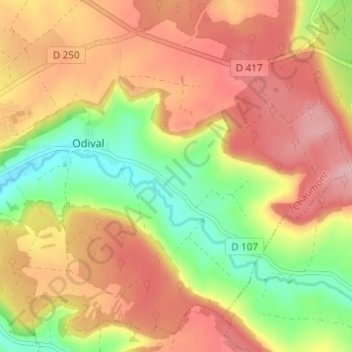
Name: Odival topographic map, elevation, terrain.
Average elevation: 406 m
Minimum elevation: 321 m
Maximum elevation: 475 m
Other topographic maps
Click on a map to view its topography, its elevation and its terrain.
Donnemarie
France > Grand Est > Haute-Marne > Nogent
Donnemarie, Nogent, Chaumont, Haute-Marne, Grand Est, France métropolitaine, 52800, France
Average elevation: 399 m