
Les Vignes d'Envaud topographic map
Interactive map
Click on the map to display elevation.
About this map
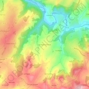
Name: Les Vignes d'Envaud topographic map, elevation, terrain.
Average elevation: 314 m
Minimum elevation: 211 m
Maximum elevation: 409 m
Other topographic maps
Click on a map to view its topography, its elevation and its terrain.
Les Gallands
France > Nouvelle-Aquitaine > Haute-Vienne > Solignac
Les Gallands, Solignac, Limoges, Haute-Vienne, Nouvelle-Aquitaine, France métropolitaine, 87110, France
Average elevation: 301 m