
Strullendorf topographic map
Interactive map
Click on the map to display elevation.
About this map
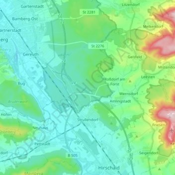
Name: Strullendorf topographic map, elevation, terrain.
Location: Strullendorf, Landkreis Bamberg, Beieren, 96129, Duitsland (49.82843 10.92845 49.89731 11.08958)
Average elevation: 297 m
Minimum elevation: 229 m
Maximum elevation: 560 m
Other topographic maps
Click on a map to view its topography, its elevation and its terrain.
Wind
Duitsland > Beieren > Landkreis Bamberg
Wind, Pommersfelden, Landkreis Bamberg, Beieren, 96178, Duitsland
Average elevation: 284 m