
Stranjani topographic map
Interactive map
Click on the map to display elevation.
About this map
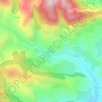
Name: Stranjani topographic map, elevation, terrain.
Average elevation: 648 m
Minimum elevation: 417 m
Maximum elevation: 989 m
Other topographic maps
Click on a map to view its topography, its elevation and its terrain.
Zenica
Bosnia and Herzegovina > Federation of Bosnia and Herzegovina > City of Zenica
Zenica, City of Zenica, Zenica-Doboj Canton, Federation of Bosnia and Herzegovina, 72000, Bosnia and Herzegovina
Average elevation: 730 m