Geolocate

Kenosha topographic map

Click on the map to display elevation.

About this map

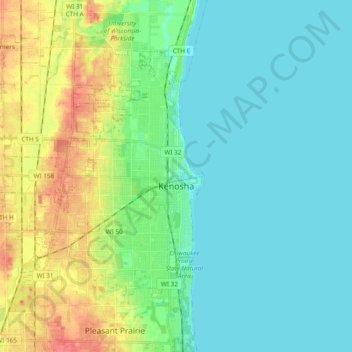
Name: Kenosha topographic map, elevation, terrain.

Location: Kenosha, Kenosha County, Wisconsin, United States (42.53775 -87.99697 42.63938 -87.80613)

Average elevation: 190 m

Minimum elevation: 174 m

Maximum elevation: 232 m

Gear up for your next adventure:

🌬️Windbreaker Jackets - Wind protection jackets
🔦Headlamps - Hands-free lighting for hiking
👖Convertible Hiking Trousers - Zip-off legs to adapt to changing temperatures throughout the day
🎽Base Layers - Thermal base layers
Ultralight Solo Tents - Compact shelters for multi-day topographic surveying expeditions

As an Amazon Associate, this site earns from qualifying purchases at no extra cost to you.