
Anchorage topographic map
Interactive map
Click on the map to display elevation.
About this map
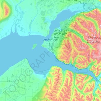
Name: Anchorage topographic map, elevation, terrain.
Location: Anchorage, Alaska, United States (60.73379 -150.42062 61.48394 -148.46001)
Average elevation: 316 m
Minimum elevation: -2 m
Maximum elevation: 2,287 m
Other topographic maps
Click on a map to view its topography, its elevation and its terrain.
Windemere
United States > Alaska > Anchorage
Windemere, Anchorage, Alaska, United States
Average elevation: 33 m
Spenard
United States > Alaska > Anchorage > Spenard
Spenard, Anchorage, Alaska, 99517, United States
Average elevation: 29 m