
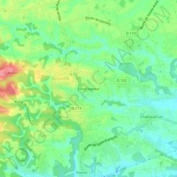
Fond Vapeur topographic map
Interactive map
Click on the map to display elevation.
About this map
Name: Fond Vapeur topographic map, elevation, terrain.
Average elevation: 35 m
Minimum elevation: 1 m
Maximum elevation: 98 m
Other topographic maps
Click on a map to view its topography, its elevation and its terrain.
Calvaire
France > Guadeloupe > Sainte-Anne > Douville
Calvaire, Douville, Sainte-Anne, Pointe-à-Pitre, Guadeloupe, 97180, France
Average elevation: 55 m