Geolocate

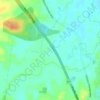
Boambee topographic map

Click on the map to display elevation.

About this map

Name: Boambee topographic map, elevation, terrain.

Location: Boambee, Coffs Harbour, New South Wales, Australia (-30.35127 153.02817 -30.31447 153.08923)

Average elevation: 18 m

Minimum elevation: -1 m

Maximum elevation: 186 m

New South Wales trails, hiking, mountain biking, running and outdoor activities

Other topographic maps

Click on a map to view its topography, its elevation and its terrain.
Red Hill

Australia > New South Wales > Coffs Harbour

Average elevation: 118 m

Dunvegan

Australia > New South Wales > Coffs Harbour

Average elevation: 165 m

Landrigans

Australia > New South Wales > Coffs Harbour

Average elevation: 157 m

Gear up for your next adventure:

🧢Outdoor Sun Hats - Sun protection hats for hiking
🛠️Outdoor Repair Kits - Gear repair kits
👖Convertible Hiking Trousers - Zip-off legs to adapt to changing temperatures throughout the day
⌚Altimeter Barometer Watches - Outdoor watches with built-in sensors to track altitude changes and weather shifts
🔦LED Torches - LED torches for outdoor use

As an Amazon Associate, this site earns from qualifying purchases at no extra cost to you.