Geolocate

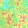
Mengla topographic map

Click on the map to display elevation.

About this map

Name: Mengla topographic map, elevation, terrain.

Location: Mengla, Mengla County, Xishuangbanna, Yunnan, 666300, China (21.30185 101.40503 21.62185 101.72503)

Average elevation: 932 m

Minimum elevation: 581 m

Maximum elevation: 1,624 m

Other topographic maps

Click on a map to view its topography, its elevation and its terrain.
Mohan

China > Yunnan > Mengla County

Average elevation: 962 m

Gear up for your next adventure:

🐍Australian Snake Bite Kits - Specific pressure immobilization bandages for Australian venomous snakes
🧭Compass - Navigation compasses for outdoor exploration
🔦Headlamps - Hands-free lighting for hiking
👟Lightweight Trail Runners - Agile footwear for fast movement over rugged Australian terrain
👄SPF Lip Balm - Prevent sun and wind-burnt lips on mountain ridges

As an Amazon Associate, this site earns from qualifying purchases at no extra cost to you.