Geolocate

Westoning topographic map

Click on the map to display elevation.

About this map

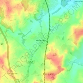
Name: Westoning topographic map, elevation, terrain.

Location: Westoning, Central Bedfordshire, England, United Kingdom (51.96756 -0.53406 51.99557 -0.46365)

Average elevation: 86 m

Minimum elevation: 61 m

Maximum elevation: 116 m

Gear up for your next adventure:

📕Australia Maps - Maps covering Australian regions
🧥Packable Rain Jackets - Breathable waterproof layers for unpredictable mountain weather
GPS Watches - GPS watches for outdoor sports
🔋Solar Power Banks - Charge your phone and GPS using the sun while deep in the bush
🎧Bluetooth Outdoor Earbuds - Listen to navigation cues or podcasts during long solo treks

As an Amazon Associate, this site earns from qualifying purchases at no extra cost to you.