Geolocate

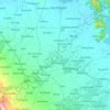
Borseth topographic map

Click on the map to display elevation.

About this map

Name: Borseth topographic map, elevation, terrain.

Location: Borseth, Alangalang, 1st District, Leyte, Eastern Visayas, 6518, Philippines (11.23835 124.79321 11.27835 124.83321)

Average elevation: 27 m

Minimum elevation: 13 m

Maximum elevation: 45 m

Other topographic maps

Click on a map to view its topography, its elevation and its terrain.
Mainit River

Philippines > Leyte > Alangalang

Average elevation: 49 m

Gear up for your next adventure:

🎽Base Layers - Thermal base layers
🍳Camping Cookware - Cookware sets for outdoor meals
💡Collapsible Camping Lanterns - Illuminate your base camp or tent for map studying at night
📡Satellite Messengers - Emergency communication devices
📚Map Reading & Navigation Guides - Master the art of interpreting topographic contours and symbols

As an Amazon Associate, this site earns from qualifying purchases at no extra cost to you.