Geolocate

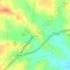
Daniels topographic map

Click on the map to display elevation.

About this map

Name: Daniels topographic map, elevation, terrain.

Location: Daniels, Washington County, Texas, United States (30.17883 -96.22579 30.21883 -96.18579)

Average elevation: 55 m

Minimum elevation: 47 m

Maximum elevation: 82 m

Other topographic maps

Click on a map to view its topography, its elevation and its terrain.
Brenham

United States > Texas > Washington County

Average elevation: 98 m

Burton

United States > Texas > Washington County

Average elevation: 132 m

Burton

United States > Texas > Washington County

Average elevation: 132 m

Brenham

United States > Texas > Washington County > Brenham

Average elevation: 98 m

Burton

United States > Texas > Washington County

Average elevation: 132 m

Gear up for your next adventure:

🎒Daypacks - Compact backpacks for short hikes
🔋Rechargeable Batteries - Eco-friendly power for high-drain GPS units and flashlights
🧼Biodegradable Outdoor Soap - Clean gear and yourself without harming the local ecosystem
🛌Sleeping Mats - Insulated mats for camping comfort
🕯️Emergency Whistles - Safety whistles for hiking

As an Amazon Associate, this site earns from qualifying purchases at no extra cost to you.