Geolocate

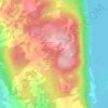
Brant Fell topographic map

Click on the map to display elevation.

About this map

Name: Brant Fell topographic map, elevation, terrain.

Location: Brant Fell, Bowness-on-Windermere, Westmorland and Furness, England, LA23 2NN, United Kingdom (54.35738 -2.90963 54.35748 -2.90953)

Average elevation: 113 m

Minimum elevation: 40 m

Maximum elevation: 220 m

Other topographic maps

Click on a map to view its topography, its elevation and its terrain.
Gear up for your next adventure:

📕Hiking Guide Books - Guides for hiking trails
🧴Sunscreen SPF - Sun protection for outdoor activities
🧤Thermal Hiking Gloves - Keep your hands warm and functional during high-altitude winter treks
🎨Portable Watercolor Kits - Paint the landscapes and topographic views you discover
🪑Portable Backpacking Chairs - A comfortable seat for studying maps at the end of the day

As an Amazon Associate, this site earns from qualifying purchases at no extra cost to you.