Geolocate

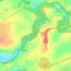
Galston topographic map

Click on the map to display elevation.

About this map
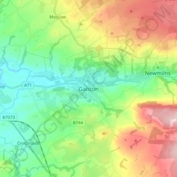
Name: Galston topographic map, elevation, terrain.

Location: Galston, East Ayrshire, Scotland, KA4 8HG, United Kingdom (55.56041 -4.41975 55.64041 -4.33975)

Average elevation: 126 m

Minimum elevation: 30 m

Maximum elevation: 297 m

Other topographic maps

Click on a map to view its topography, its elevation and its terrain.

Braid Wood

United Kingdom > Scotland > East Ayrshire

Average elevation: 114 m

Glenbuck Loch

United Kingdom > Scotland > East Ayrshire

Average elevation: 327 m

Loch Doon

United Kingdom > Scotland > East Ayrshire

Average elevation: 291 m

River Doon

United Kingdom > Scotland > East Ayrshire > Dalrymple

Average elevation: 168 m

River Ayr

United Kingdom > Scotland > East Ayrshire

Average elevation: 210 m

Gear up for your next adventure:

🧼Clip-on Hand Sanitizer - Maintain hygiene when water for washing is scarce
🪑Portable Backpacking Chairs - A comfortable seat for studying maps at the end of the day
🧤Hiking Gloves - Protective gloves for outdoor use
🔦Headlamps - Hands-free lighting for hiking
🏃Compression Recovery Socks - Reduce leg fatigue after heavy days of elevation gain

As an Amazon Associate, this site earns from qualifying purchases at no extra cost to you.