Geolocate

Mayer topographic map

Click on the map to display elevation.

About this map
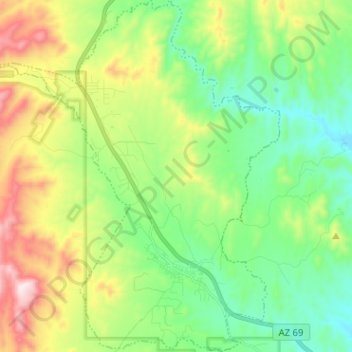
Name: Mayer topographic map, elevation, terrain.

Location: Mayer, Yavapai County, Arizona, United States (34.37394 -112.30922 34.47878 -112.19937)

Average elevation: 1,427 m

Minimum elevation: 1,210 m

Maximum elevation: 1,866 m

Gear up for your next adventure:

🧢Wide Brim Sun Hats - Maximum coverage for the face and neck while out in the open
🎒Daypacks - Compact backpacks for short hikes
🔑Heavy Duty Carabiners - Secure gear to the outside of your pack for easy access
🔦Powerful LED Headlamps - Hands-free lighting for night navigation and setting up camp after dark
🧥Softshell Jackets - Flexible outdoor jackets

As an Amazon Associate, this site earns from qualifying purchases at no extra cost to you.