
Centro Sur topographic map
Interactive map
Click on the map to display elevation.
About this map
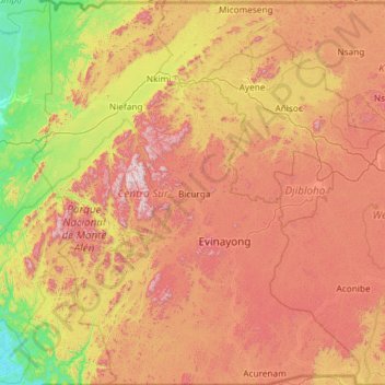
Name: Centro Sur topographic map, elevation, terrain.
Location: Centro Sur, Región Continental, Guinea Ecuatorial (0.99994 9.96404 2.17254 10.96212)
Average elevation: 518 m
Minimum elevation: 1 m
Maximum elevation: 1,197 m
Other topographic maps
Click on a map to view its topography, its elevation and its terrain.
Bioko Norte
Guinea Ecuatorial > Bioko Norte
Bioko Norte, Región Insular, Guinea Ecuatorial
Average elevation: 148 m
Bioko
Bioko, Bioko Sur, Región Insular, 240, Guinea Ecuatorial
Average elevation: 301 m