Geolocate

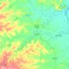
Yedur topographic map

Click on the map to display elevation.

About this map

Name: Yedur topographic map, elevation, terrain.

Location: Yedur, Deglur, Nanded District, Maharashtra, India (18.26676 77.46899 18.30676 77.50899)

Average elevation: 508 m

Minimum elevation: 477 m

Maximum elevation: 546 m

Other topographic maps

Click on a map to view its topography, its elevation and its terrain.
Lendi

India > Maharashtra > Deglur

Average elevation: 396 m

Gear up for your next adventure:

🥶Thermal Beanies - Warm hats for cold hikes
🎒40L Day Hiking Backpacks - Comfortable packs with hydration support for long days exploring topographic peaks
🔪Outdoor Multi-tools - Versatile tools for gear repair and survival tasks in the wilderness
🐍Australian Snake Bite Kits - Specific pressure immobilization bandages for Australian venomous snakes
🧭Military Style Lensatic Compass - Durable sighting compasses for advanced land navigation and surveying

As an Amazon Associate, this site earns from qualifying purchases at no extra cost to you.