
Kumla kommun topographic map
Interactive map
Click on the map to display elevation.
About this map
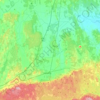
Name: Kumla kommun topographic map, elevation, terrain.
Location: Kumla kommun, Provincia de Örebro, Svealand, Suecia (59.04662 14.91793 59.18926 15.35858)
Average elevation: 65 m
Minimum elevation: 21 m
Maximum elevation: 172 m
Other topographic maps
Click on a map to view its topography, its elevation and its terrain.
Ljusnarsbergs kommun
Ljusnarsbergs kommun, Provincia de Örebro, Svealand, Suecia
Average elevation: 253 m
Lekeberg
Lekeberg, Landskapet Närke, Provincia de Örebro, Svealand, Suecia
Average elevation: 103 m
Provincia de Örebro
Provincia de Örebro, Svealand, Suecia
Average elevation: 122 m
Örebro
Örebro, Landskapet Närke, Provincia de Örebro, Svealand, Suecia
Average elevation: 73 m