
Thank you for supporting this site ❤️
Make a donation
Make a donation
Gear up for your next adventure:
As an Amazon Associate, this site earns from qualifying purchases at no extra cost to you.
Amaiur topographic map
Click on the map to display elevation.
Thank you for supporting this site ❤️
Make a donation
Make a donation
Gear up for your next adventure:
As an Amazon Associate, this site earns from qualifying purchases at no extra cost to you.
About this map
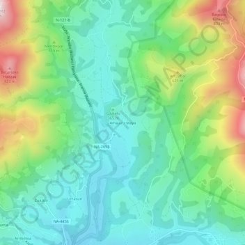
Name: Amaiur topographic map, elevation, terrain.
Location: Amaiur, Baztan, Baztan-Bidasoa, Navarre, 31715, Spain (43.18163 -1.49882 43.22163 -1.45882)
Average elevation: 438 m
Minimum elevation: 244 m
Maximum elevation: 887 m
Thank you for supporting this site ❤️
Make a donation
Make a donation
Gear up for your next adventure:
As an Amazon Associate, this site earns from qualifying purchases at no extra cost to you.