
Make a donation
Gear up for your next adventure:
As an Amazon Associate, this site earns from qualifying purchases at no extra cost to you.
Okavango Delta topographic map
Click on the map to display elevation.
Make a donation
Gear up for your next adventure:
As an Amazon Associate, this site earns from qualifying purchases at no extra cost to you.
Okavango Delta
The Okavango Delta or Okavango Grassland is a vast inland delta in Botswana formed where the Okavango River reaches a tectonic trough at an elevation of 930–1,000 m (3,050–3,280 ft) in the central part of the endorheic basin of the Kalahari Desert.
Make a donation
Gear up for your next adventure:
As an Amazon Associate, this site earns from qualifying purchases at no extra cost to you.
About this map
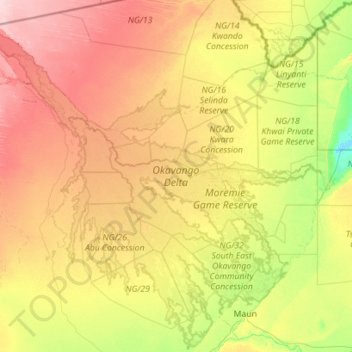
Name: Okavango Delta topographic map, elevation, terrain.
Location: Okavango Delta, North-West District, Botswana (-20.19750 21.66445 -18.11046 23.90722)
Average elevation: 959 m
Minimum elevation: 918 m
Maximum elevation: 1,039 m
Make a donation
Gear up for your next adventure:
As an Amazon Associate, this site earns from qualifying purchases at no extra cost to you.