Geolocate

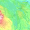
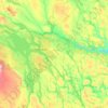
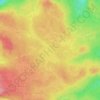
Kaxås topographic map

Click on the map to display elevation.

About this map

Name: Kaxås topographic map, elevation, terrain.

Location: Kaxås, Krokoms kommun, Jämtland County, 835 97, Sweden (63.47559 13.87818 63.51559 13.91818)

Average elevation: 369 m

Minimum elevation: 314 m

Maximum elevation: 463 m

Other topographic maps

Click on a map to view its topography, its elevation and its terrain.
Bräcke kommun

Sweden > Jämtland County

Average elevation: 340 m

Storsjön

Sweden > Jämtland County

Average elevation: 404 m

Bergs kommun

Sweden > Jämtland County

Average elevation: 575 m

Strömsunds kommun

Sweden > Jämtland County

Average elevation: 475 m

Härjedalens kommun

Sweden > Jämtland County

Average elevation: 563 m

Östersunds kommun

Sweden > Jämtland County

Average elevation: 372 m

Rogen

Sweden > Jämtland County

Average elevation: 802 m

Näkten

Sweden > Jämtland County

Average elevation: 374 m

Storulvån

Sweden > Jämtland County

Average elevation: 928 m

Bräcke kommun

Sweden > Jämtland County

Average elevation: 340 m

Krokoms kommun

Sweden > Jämtland County

Average elevation: 501 m

Delsjön

Sweden > Jämtland County

Average elevation: 410 m

Edsåsen

Sweden > Jämtland County

Average elevation: 445 m

Krokoms kommun

Sweden > Jämtland County

Average elevation: 501 m

Sonfjället

Sweden > Jämtland County

Average elevation: 685 m

Ragunda kommun

Sweden > Jämtland County

Average elevation: 315 m

Bergs kommun

Sweden > Jämtland County

Average elevation: 575 m

Finnån

Sweden > Jämtland County

Average elevation: 596 m

Gear up for your next adventure:

🛌Compact Down Sleeping Bags - Warmth without the bulk, ideal for backcountry camping
🥶Thermal Beanies - Warm hats for cold hikes
🛌Sleeping Mats - Insulated mats for camping comfort
⌚Altimeter Watches - Watches with altitude tracking
🕶️Polarized Sunglasses - UV protection sunglasses for outdoors

As an Amazon Associate, this site earns from qualifying purchases at no extra cost to you.