
Thank you for supporting this site ❤️
Make a donation
Make a donation
Gear up for your next adventure:
As an Amazon Associate, this site earns from qualifying purchases at no extra cost to you.
Sierras topographic map
Click on the map to display elevation.
Thank you for supporting this site ❤️
Make a donation
Make a donation
Gear up for your next adventure:
As an Amazon Associate, this site earns from qualifying purchases at no extra cost to you.
About this map
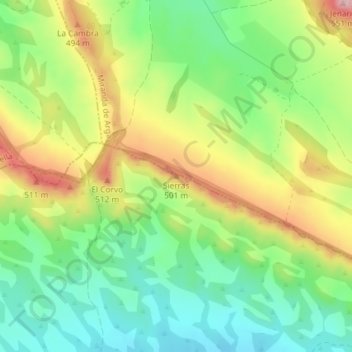
Name: Sierras topographic map, elevation, terrain.
Location: Sierras, Falces, Erriberagoiena / Ribera Alta, Spain (42.45382 -1.87651 42.45392 -1.87641)
Average elevation: 427 m
Minimum elevation: 352 m
Maximum elevation: 534 m
Thank you for supporting this site ❤️
Make a donation
Make a donation
Gear up for your next adventure:
As an Amazon Associate, this site earns from qualifying purchases at no extra cost to you.