
Thank you for supporting this site ❤️
Make a donation
Make a donation
Gear up for your next adventure:
As an Amazon Associate, this site earns from qualifying purchases at no extra cost to you.
Proddatur topographic map
Click on the map to display elevation.
Thank you for supporting this site ❤️
Make a donation
Make a donation
Gear up for your next adventure:
As an Amazon Associate, this site earns from qualifying purchases at no extra cost to you.
About this map
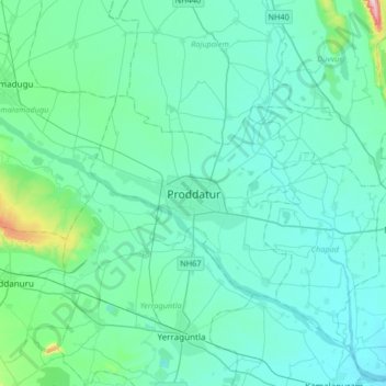
Name: Proddatur topographic map, elevation, terrain.
Location: Proddatur, YSR Kadapa, Andhra Pradesh, 516360, India (14.59560 78.39015 14.91560 78.71015)
Average elevation: 168 m
Minimum elevation: 130 m
Maximum elevation: 467 m
Thank you for supporting this site ❤️
Make a donation
Make a donation
Gear up for your next adventure:
As an Amazon Associate, this site earns from qualifying purchases at no extra cost to you.