
Make a donation
Gear up for your next adventure:
As an Amazon Associate, this site earns from qualifying purchases at no extra cost to you.
Idalou topographic map
Click on the map to display elevation.
Make a donation
Gear up for your next adventure:
As an Amazon Associate, this site earns from qualifying purchases at no extra cost to you.
About this map
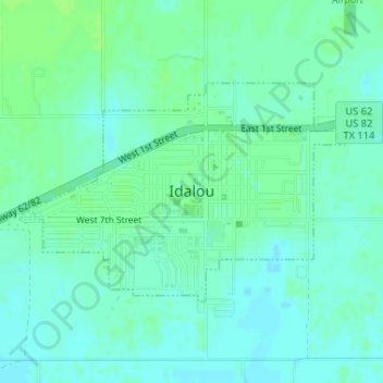
Name: Idalou topographic map, elevation, terrain.
Location: Idalou, Lubbock County, Texas, United States (33.65445 -101.69856 33.66986 -101.67097)
Average elevation: 973 m
Minimum elevation: 968 m
Maximum elevation: 977 m
Make a donation
Gear up for your next adventure:
As an Amazon Associate, this site earns from qualifying purchases at no extra cost to you.
Other topographic maps
Click on a map to view its topography, its elevation and its terrain.
Shallowater
United States > Texas > Lubbock County > Shallowater > Shallowater
Average elevation: 1,009 m
Make a donation
Gear up for your next adventure:
As an Amazon Associate, this site earns from qualifying purchases at no extra cost to you.
Buffalo Springs Lake Dam
United States > Texas > Lubbock County > Buffalo Springs
Average elevation: 939 m