
Bassigny topographic map
Interactive map
Click on the map to display elevation.
About this map
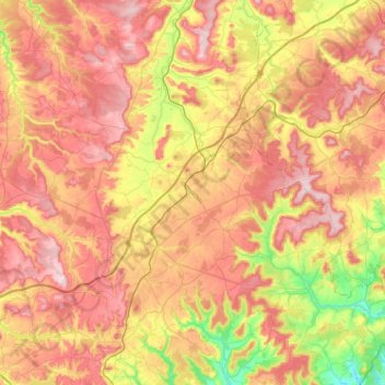
Name: Bassigny topographic map, elevation, terrain.
Average elevation: 373 m
Minimum elevation: 233 m
Maximum elevation: 507 m
Other topographic maps
Click on a map to view its topography, its elevation and its terrain.
Saint-Dizier
France > Grand Est > Haute-Marne
Saint-Dizier, Haute-Marne, Grand Est, Metropolitan France, 52100, France
Average elevation: 163 m
Froncles
France > Grand Est > Haute-Marne > Froncles
Froncles, Chaumont, Haute-Marne, Grand Est, Metropolitan France, 52320, France
Average elevation: 287 m
Joinville
France > Grand Est > Haute-Marne
Joinville, Saint-Dizier, Haute-Marne, Grand Est, Metropolitan France, 52300, France
Average elevation: 266 m