
Thank you for supporting this site ❤️
Make a donation
Make a donation
Gear up for your next adventure:
As an Amazon Associate, this site earns from qualifying purchases at no extra cost to you.
Colombatti topographic map
Click on the map to display elevation.
Thank you for supporting this site ❤️
Make a donation
Make a donation
Gear up for your next adventure:
As an Amazon Associate, this site earns from qualifying purchases at no extra cost to you.
About this map
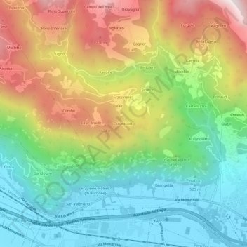
Name: Colombatti topographic map, elevation, terrain.
Location: Colombatti, Condove, Torino, Piedmont, 10055, Italy (45.10813 7.25805 45.14813 7.29805)
Average elevation: 774 m
Minimum elevation: 371 m
Maximum elevation: 1,409 m
Thank you for supporting this site ❤️
Make a donation
Make a donation
Gear up for your next adventure:
As an Amazon Associate, this site earns from qualifying purchases at no extra cost to you.