Geolocate

Greenville topographic map

Click on the map to display elevation.

About this map

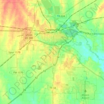
Name: Greenville topographic map, elevation, terrain.

Location: Greenville, Hunt County, Texas, United States (33.05161 -96.17017 33.17264 -96.04800)

Average elevation: 164 m

Minimum elevation: 144 m

Maximum elevation: 189 m

Gear up for your next adventure:

🎒3L Hydration Reservoirs - Hands-free drinking to stay hydrated on steep contour climbs
🩹Wilderness First Aid Kits - Comprehensive medical kits tailored for hiking and remote exploration
🔋Rechargeable Batteries - Eco-friendly power for high-drain GPS units and flashlights
🧥Softshell Jackets - Flexible outdoor jackets
🎒Dry Bags - Waterproof bags for outdoor gear

As an Amazon Associate, this site earns from qualifying purchases at no extra cost to you.