Geolocate
👉 Easily get elevation data in JSON, GeoTIFF and KML formats using Elevation API
Thank you for supporting this site ❤️
Make a donation

Gear up for your next adventure:

As an Amazon Associate, this site earns from qualifying purchases at no extra cost to you.

Benkel topographic map

Click on the map to display elevation.

About this map

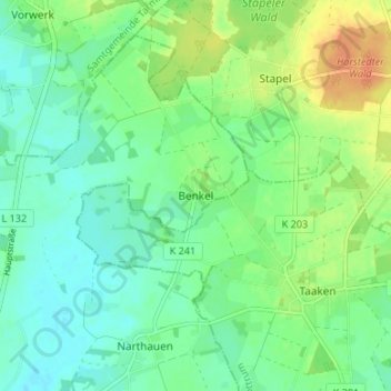
Name: Benkel topographic map, elevation, terrain.

Location: Benkel, Ottersberg, Landkreis Verden, Niedersachsen, Deutschland (53.14810 9.16626 53.18810 9.20626)

Average elevation: 29 m

Minimum elevation: 16 m

Maximum elevation: 53 m

Gear up for your next adventure:

🪢550 Survival Paracord - Versatile cordage for gear repair and emergency lashing
🧼Biodegradable Soap - Eco-friendly outdoor soap
🏫Topographic World Globes - 3D physical relief globes to understand global geography
🧥Down Jackets - Insulated jackets for cold weather
👣Snake & Scrub Gaiters - Protection against spinifex, mud, and snakes while walking off-track

As an Amazon Associate, this site earns from qualifying purchases at no extra cost to you.