
St Johns topographic map
Interactive map
Click on the map to display elevation.
About this map
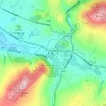
Name: St Johns topographic map, elevation, terrain.
Location: St Johns, German, Glenfaba, Isle of Man (54.18243 -4.66204 54.22243 -4.62204)
Average elevation: 113 m
Minimum elevation: 13 m
Maximum elevation: 326 m