
Tewkesbury topographic map
Interactive map
Click on the map to display elevation.
About this map
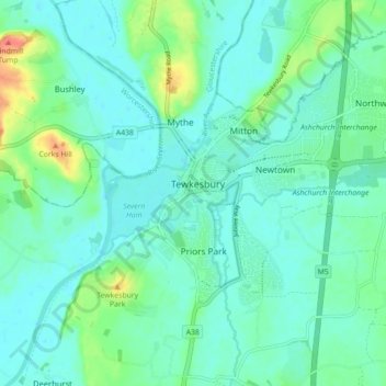
Name: Tewkesbury topographic map, elevation, terrain.
Location: Tewkesbury, Gloucestershire, England, United Kingdom (51.96527 -2.19195 52.01974 -2.12112)
Average elevation: 18 m
Minimum elevation: 6 m
Maximum elevation: 61 m