Geolocate

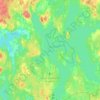
Ulvaskog topographic map

Click on the map to display elevation.

About this map

Name: Ulvaskog topographic map, elevation, terrain.

Location: Ulvaskog, Lessebo kommun, Kronoberg County, Sweden (56.78916 15.48443 56.82916 15.52443)

Average elevation: 220 m

Minimum elevation: 186 m

Maximum elevation: 245 m

Other topographic maps

Click on a map to view its topography, its elevation and its terrain.
Helgasjön

Sweden > Kronoberg County > Åby

Average elevation: 173 m

Lessebo kommun

Sweden > Kronoberg County

Average elevation: 178 m

Växjö kommun

Sweden > Kronoberg County

Average elevation: 191 m

Tingsryds kommun

Sweden > Kronoberg County

Average elevation: 138 m

Markaryds kommun

Sweden > Kronoberg County

Average elevation: 137 m

England

Sweden > Kronoberg County > Markaryd

Average elevation: 107 m

Gear up for your next adventure:

📚Map Reading & Navigation Guides - Master the art of interpreting topographic contours and symbols
⌛Survival Blankets - Emergency thermal blankets
🦯Trekking Poles - Walking poles for hiking stability
🧤Hiking Gloves - Protective gloves for outdoor use
🧼Clip-on Hand Sanitizer - Maintain hygiene when water for washing is scarce

As an Amazon Associate, this site earns from qualifying purchases at no extra cost to you.