
Diriamba (Municipio) topographic map
Interactive map
Click on the map to display elevation.
Diriamba (Municipio)
The city's elevation (just above 500 meters above sea level), and the geography of the cordillera upon which it sits, lend it a constantly mild weather (though notoriously windy January through March).
About this map
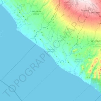
Name: Diriamba (Municipio) topographic map, elevation, terrain.
Location: Diriamba (Municipio), Carazo, 46300, Nicaragua (11.49292 -86.58358 11.89648 -86.21508)
Average elevation: 101 m
Minimum elevation: 0 m
Maximum elevation: 675 m