Geolocate

Telmar topographic map

Click on the map to display elevation.

About this map
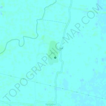
Name: Telmar topographic map, elevation, terrain.

Location: Telmar, Harnaut, Nalanda, Bihar, India (25.42034 85.43449 25.42657 85.43817)

Average elevation: 46 m

Minimum elevation: 44 m

Maximum elevation: 49 m

Other topographic maps

Click on a map to view its topography, its elevation and its terrain.
Dihri Garh

India > Bihar > Harnaut

Average elevation: 46 m

Gear up for your next adventure:

🧥Softshell Jackets - Flexible outdoor jackets
☀️Portable Solar Chargers - High-efficiency panels to hang on your backpack while walking
🎒Tactical Waist Packs - Quick access to your compass, phone, and snacks while walking
⛺Lightweight Tents - Compact tents for backpacking
🖼️Scratch-off Australia Map - Track the regions and peaks you have explored geographically

As an Amazon Associate, this site earns from qualifying purchases at no extra cost to you.