Geolocate

San Angel topographic map

Click on the map to display elevation.

About this map

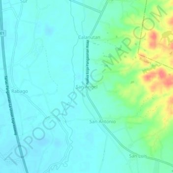
Name: San Angel topographic map, elevation, terrain.

Location: San Angel, Pangasinan, Ilocos Region, Philippines (15.83041 120.62437 15.87041 120.66437)

Average elevation: 39 m

Minimum elevation: 25 m

Maximum elevation: 84 m

Gear up for your next adventure:

🎒Tactical Waist Packs - Quick access to your compass, phone, and snacks while walking
☀️Portable Solar Chargers - High-efficiency panels to hang on your backpack while walking
🧼Clip-on Hand Sanitizer - Maintain hygiene when water for washing is scarce
🩹Wilderness First Aid Kits - Comprehensive medical kits tailored for hiking and remote exploration
🎽Base Layers - Thermal base layers

As an Amazon Associate, this site earns from qualifying purchases at no extra cost to you.