
Focuri topographic map
Interactive map
Click on the map to display elevation.
About this map
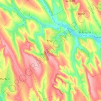
Name: Focuri topographic map, elevation, terrain.
Location: Focuri, Iași, 707195, Romania (47.29458 27.12848 47.38942 27.25810)
Average elevation: 120 m
Minimum elevation: 51 m
Maximum elevation: 188 m
Other topographic maps
Click on a map to view its topography, its elevation and its terrain.