
Thank you for supporting this site ❤️
Make a donation
Make a donation
Gear up for your next adventure:
As an Amazon Associate, this site earns from qualifying purchases at no extra cost to you.
Naḍur topographic map
Click on the map to display elevation.
Thank you for supporting this site ❤️
Make a donation
Make a donation
Gear up for your next adventure:
As an Amazon Associate, this site earns from qualifying purchases at no extra cost to you.
About this map
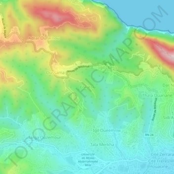
Name: Naḍur topographic map, elevation, terrain.
Location: Naḍur, Bejaia, Bejaia District, Bejaia, 06000, Algeria (36.74810 5.01652 36.78810 5.05652)
Average elevation: 150 m
Minimum elevation: 0 m
Maximum elevation: 485 m
Thank you for supporting this site ❤️
Make a donation
Make a donation
Gear up for your next adventure:
As an Amazon Associate, this site earns from qualifying purchases at no extra cost to you.