Geolocate

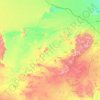
Jubbah topographic map

Click on the map to display elevation.

About this map

Name: Jubbah topographic map, elevation, terrain.

Location: Jubbah, Hail, Ḥa'il Province, Saudi Arabia (27.97685 40.91299 28.05685 40.99299)

Average elevation: 837 m

Minimum elevation: 797 m

Maximum elevation: 1,238 m

Other topographic maps

Click on a map to view its topography, its elevation and its terrain.

Baqa

Saudi Arabia > Ḥa'il Province

Average elevation: 695 m

Hail

Saudi Arabia > Ḥa'il Province

Average elevation: 936 m

Baqa

Saudi Arabia > Ḥa'il Province

Average elevation: 695 m

Arkan

Saudi Arabia > Ḥa'il Province

Average elevation: 1,042 m

Mawqaq

Saudi Arabia > Ḥa'il Province

Average elevation: 1,009 m

Al Dhahira

Saudi Arabia > Ḥa'il Province > Baqa

Average elevation: 695 m

Ash Shinan

Saudi Arabia > Ḥa'il Province

Average elevation: 869 m

Gear up for your next adventure:

🧴Sunscreen SPF - Sun protection for outdoor activities
👖Convertible Hiking Trousers - Zip-off legs to adapt to changing temperatures throughout the day
🏕️Camping Gear - Essential camping equipment
📦Crushproof Equipment Cases - Safe transport for sensitive surveying and mapping instruments
📍Handheld GPS - GPS devices for hiking and navigation

As an Amazon Associate, this site earns from qualifying purchases at no extra cost to you.