Geolocate

Yomitan topographic map

Click on the map to display elevation.

About this map

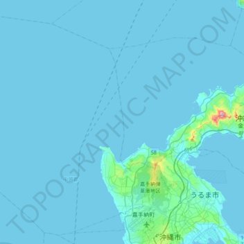
Name: Yomitan topographic map, elevation, terrain.

Location: Yomitan, Nakagami, Okinawa Prefecture, Japan (26.33615 127.46304 26.60362 127.78603)

Average elevation: 11 m

Minimum elevation: 0 m

Maximum elevation: 352 m

Gear up for your next adventure:

🛰️Handheld GPS Units - Rugged GPS devices for tracking coordinates and elevation in the Australian bush
🚗Car Camping Gear - Equipment for vehicle camping
💧Personal Water Filters - Drink safely from streams and lakes identified on your map
🔥Ferrocerium Rod Fire Starters - Reliable fire lighting in wet or windy conditions without matches
🛌Sleeping Mats - Insulated mats for camping comfort

As an Amazon Associate, this site earns from qualifying purchases at no extra cost to you.