Geolocate

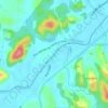
Guarani topographic map

Click on the map to display elevation.

About this map

Name: Guarani topographic map, elevation, terrain.

Location: Guarani, Brusque, Região Geográfica Imediata de Brusque, Região Geográfica Intermediária de Blumenau, Santa Catarina, Região Sul, 88350-660, Brasil (-27.11438 -48.95663 -27.08555 -48.92726)

Average elevation: 74 m

Minimum elevation: 14 m

Maximum elevation: 234 m

Other topographic maps

Click on a map to view its topography, its elevation and its terrain.
Rio Itajaí-Mirim

Brasil > Santa Catarina > Brusque

Average elevation: 29 m

Gear up for your next adventure:

🛠️Outdoor Repair Kits - Gear repair kits
🎒40L Day Hiking Backpacks - Comfortable packs with hydration support for long days exploring topographic peaks
📻Handheld UHF Radios - Critical communication for groups in the Australian outback
🔋Solar Power Banks - Solar chargers for outdoors
🧰Survival Kits - Essential survival gear

As an Amazon Associate, this site earns from qualifying purchases at no extra cost to you.