Geolocate

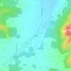
Grants Pass topographic map

Click on the map to display elevation.

About this map
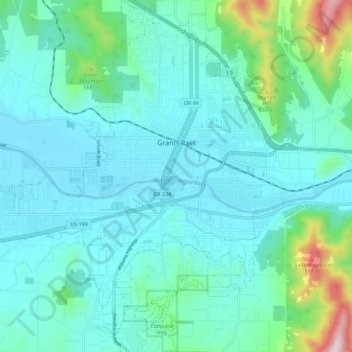
Name: Grants Pass topographic map, elevation, terrain.

Location: Grants Pass, Josephine County, Oregon, United States (42.38970 -123.39129 42.47301 -123.28256)

Average elevation: 377 m

Minimum elevation: 268 m

Maximum elevation: 953 m

Other topographic maps

Click on a map to view its topography, its elevation and its terrain.
Williams

United States > Oregon > Josephine County

Average elevation: 484 m

Hugo

United States > Oregon > Josephine County

Average elevation: 478 m

Wolf Creek

United States > Oregon > Josephine County

Average elevation: 522 m

Merlin

United States > Oregon > Josephine County

Average elevation: 308 m

Galice

United States > Oregon > Josephine County

Average elevation: 402 m

Golden

United States > Oregon > Josephine County

Average elevation: 666 m

Three Pines

United States > Oregon > Josephine County

Average elevation: 372 m

Murphy

United States > Oregon > Josephine County

Average elevation: 393 m

Lake Selmac

United States > Oregon > Josephine County

Average elevation: 444 m

Wonder

United States > Oregon > Josephine County

Average elevation: 447 m

Gear up for your next adventure:

📷Backpack Camera Clips - Quick access to your camera while keeping your hands free for climbing
🧤Hiking Gloves - Protective gloves for outdoor use
🎨Portable Watercolor Kits - Paint the landscapes and topographic views you discover
🎒Ultralight Backpacks - Lightweight packs for long hikes
🧊Insulated Stainless Steel Flasks - Keep water cold for 24 hours in the heat or coffee hot in the cold

As an Amazon Associate, this site earns from qualifying purchases at no extra cost to you.