Geolocate

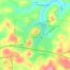
Armbrust topographic map

Click on the map to display elevation.

About this map

Name: Armbrust topographic map, elevation, terrain.

Location: Armbrust, Hempfield Township, Westmoreland County, Pennsylvania, 15616, United States (40.20368 -79.57115 40.24368 -79.53115)

Average elevation: 330 m

Minimum elevation: 283 m

Maximum elevation: 404 m

Other topographic maps

Click on a map to view its topography, its elevation and its terrain.
Gear up for your next adventure:

🧥Softshell Jackets - Flexible outdoor jackets
🚴Bike GPS - GPS devices for cycling
🧤Thermal Hiking Gloves - Keep your hands warm and functional during high-altitude winter treks
🔋Solar Power Banks - Solar chargers for outdoors
👕UPF 50+ Sun Shirts - Essential protection against the harsh Australian sun during field work

As an Amazon Associate, this site earns from qualifying purchases at no extra cost to you.