
Shetaj topographic map
Interactive map
Click on the map to display elevation.
About this map
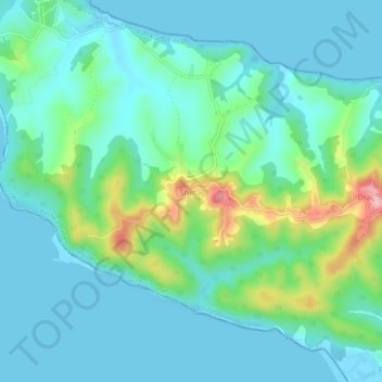
Name: Shetaj topographic map, elevation, terrain.
Location: Shetaj, Durrës, Qark Durrës, Nord-Albanien, 2016, Albanien (41.53713 19.46750 41.57713 19.50750)
Average elevation: 40 m
Minimum elevation: -4 m
Maximum elevation: 191 m