Geolocate

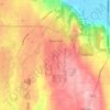
Bromart topographic map

Click on the map to display elevation.

About this map

Name: Bromart topographic map, elevation, terrain.

Location: Bromart, Silver Firs, Snohomish County, Washington, 98291, United States (47.87351 -122.11911 47.91351 -122.07911)

Average elevation: 8 m

Minimum elevation: -3 m

Maximum elevation: 103 m

Other topographic maps

Click on a map to view its topography, its elevation and its terrain.
Gear up for your next adventure:

👣Snake & Scrub Gaiters - Protection against spinifex, mud, and snakes while walking off-track
🔦LED Torches - LED torches for outdoor use
🥤Outdoor Water Bottles - Reusable bottles for outdoor activities
🔋Rechargeable Batteries - Eco-friendly power for high-drain GPS units and flashlights
📕Australia Maps - Maps covering Australian regions

As an Amazon Associate, this site earns from qualifying purchases at no extra cost to you.