Geolocate

Karaca Dağ topographic map

Click on the map to display elevation.

About this map

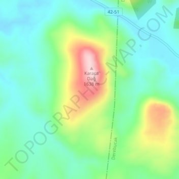
Name: Karaca Dağ topographic map, elevation, terrain.

Location: Karaca Dağ, Beyşehir, Konya, Central Anatolia Region, Turkey (37.46984 31.61524 37.46994 31.61534)

Average elevation: 1,452 m

Minimum elevation: 1,373 m

Maximum elevation: 1,643 m

Gear up for your next adventure:

🧢Wide Brim Sun Hats - Maximum coverage for the face and neck while out in the open
🪫Rechargeable Headlamps - USB rechargeable headlamps
🧦Hiking Socks - Comfortable socks for long hikes
🏫Topographic World Globes - 3D physical relief globes to understand global geography
Ultralight Solo Tents - Compact shelters for multi-day topographic surveying expeditions

As an Amazon Associate, this site earns from qualifying purchases at no extra cost to you.