Geolocate

Caldwell topographic map

Click on the map to display elevation.

About this map

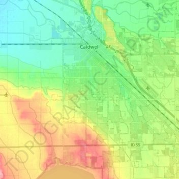
Name: Caldwell topographic map, elevation, terrain.

Location: Caldwell, Canyon County, Idaho, United States (43.58259 -116.72332 43.69779 -116.58340)

Average elevation: 742 m

Minimum elevation: 705 m

Maximum elevation: 803 m

Gear up for your next adventure:

🎽Base Layers - Thermal base layers
🌿Flora and Fauna Field Guides - Identify the plants and animals you encounter on your route
🧼Biodegradable Soap - Eco-friendly outdoor soap
🔪Multitools - Compact tools for outdoor use
🧰Survival Kits - Essential survival gear

As an Amazon Associate, this site earns from qualifying purchases at no extra cost to you.