Geolocate

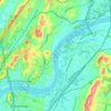
Old Farm topographic map

Click on the map to display elevation.

About this map

Name: Old Farm topographic map, elevation, terrain.

Location: Old Farm, Chattanooga, Hamilton County, East Tennessee, Tennessee, 37419, United States (35.03980 -85.36913 35.07980 -85.32913)

Average elevation: 261 m

Minimum elevation: 189 m

Maximum elevation: 565 m

Other topographic maps

Click on a map to view its topography, its elevation and its terrain.
Gear up for your next adventure:

🚁Camera Drones with GPS - Capture aerial views of the landscape to compare with topo maps
🏕️Camping Gear - Essential camping equipment
🍳Camping Cookware - Cookware sets for outdoor meals
🥤Hydration Packs - Hydration systems for hiking
🌬️Windbreaker Jackets - Wind protection jackets

As an Amazon Associate, this site earns from qualifying purchases at no extra cost to you.